Tuesday, July 31, 2018

The Horn, Saddleback Mountain and The Hiker Hut

I got an early start this morning, after coffee with NO slugs. We broke camp and set out at about 7:45 a.m., climbing from the lean-to's elevation of about 2,920 feet toward the 3,500-foot Saddleback Junior. Once we reached this summit, I could see The Horn (also called "Saddleback Horn") and Saddleback Mountain, which are 4,000-foot alpine peaks within the same ridge, surrounded by miles of dense forest. Summiting these peaks would include steep climbs and descents covering about 4 miles. I gritted my teeth and began the approach to The Horn.

It was a tough, tiring climb. At about 3,500 feet we broke out of the treeline and walked over rocks to the summit of The Horn. From there, we were rewarded with incredible views of the surrounding area and the 2-mile ridge walk we would take south toward Saddleback Mountain.


Although there were some high clouds, we were lucky to have mostly sunny weather today. The following photograph was taken 1.3 miles before the Saddleback summit. You can see the Trail winding it's way to the top.


When we reached the summit of Saddleback Mountain, the views were just breathtaking. I video-chatted with my wife so she could see it with me. To the West we could see the Rangeley Lakes, and to the east we could see more high peaks.


Forest took a much deserved rest in the shade under a rock outcropping while I had lunch. It doesn't look very comfortable, but he was snoring in just minutes.


When we got going again, we were facing 2.2 steep miles down and then what looked like 4 easy miles past Ethel and Eddy Ponds and the Piazza Rock Lean-to to the Piazza Rock Trailhead (ME 4/Main St.), where my next resupply package was waiting.

We made it to The Hiker Hut in Plantation of Sandy River, Maine, at about 5 p.m. I picked up my resupply package and took an outdoor solar shower. The owner of the hostel (Steve; The Hiker Hut) had burgers and potato salad for those of us spending the night. He's a very nice and accommodating guy and had saved a bunk for us. After I ate, we hopped the shuttle into Rangeley, one of the nearest towns. The Hiker Hut is very off-grid and doesn't have electrical outlets, so I needed to go into town to a restaurant to charge my phone and battery pack. While everything was charging, I ordered and ate a salad. Exhausted, we headed back to crash at the hostel at about 8 p.m.

Monday, July 30, 2018

Poplar Ridge Lean-to

********WARNING: NOT FOR THE SQUEAMISH********
Well alllllllrighty then. I got up at 5:30 this morning eager to start the day. As always, I boiled water for my Breakfast Essentials/instant coffee mix and drank it before full daylight. I kept wondering why it was lumpy and tasted different, why my lips and nose felt numb, and why I seemed to need to go to the bathroom more than usual all morning. A little later, I went to clean my pot and put on my shoes and realized what had happened. There were slugs everywhere. I had boiled a slug and mixed it with my drink. Note to self: check pot with phone flashlight or headlamp before mixing morning coffee. 😱

I had set my sights on a 14.9-mile hike for today, but I just didn't realize the rigors of this terrain. This bleeping section of the Trail goes straight up and straight down, over and over and over again. After leaving camp at about 9 a.m., we headed across and down Lone Mountain, followed by a 1,750-foot descent to Oberton Stream. After crossing the stream, we climbed Poplar Ridge, another steep ascent.


After this climb, we were completely exhausted, so I decided to set up camp near the Poplar Ridge Lean-to (Mile Marker 209.7).

Sugarloaf and Spaulding Mountains; Spaulding Mountain Lean-to

We spent a nerve-wracking night in the gap between North and South Crocker Mountains watching lightning and listening to thunder all around us. Every crack of a tree limb made me jump, nervous about limbs or even trees falling on our hammocks. This morning, we got a slow start as I was hoping for a break in the rain and wanted to give my shoes a chance to dry a little. I also rolled my ankle again yesterday, and it was sore when I woke up this morning. Finally, I got Forest out of his hammock and packed up. We got on the move at about 11:30 a.m.


A relatively easy walk through the woods, our hike started out with simultaneous sunshine and rain. Most people probably think it would be miserable hiking under these conditions, but I actually like it. It kind of matches my mood. Sunshine and rain.


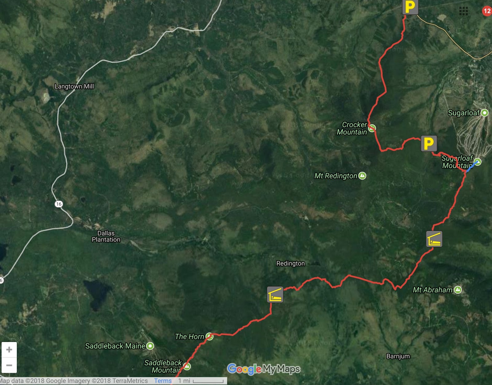
We hiked about a mile, navigating tree roots and rocks, before working our way up to a pretty steep climb to the peak of South Crocker Mountain. It got cloudier as we went. There were just high peaks and deep notches in this section of the Trail, as we passed Sugarloaf and Spaulding Mountains; no continuing ridgelines, no low points. This is just the way it's going to be for the rest of Maine and through the White Mountains in New Hampshire.


I set out carrying 4 liters of water today, which turned out to be unnecessary with all of the little streams running with rainwater in the gap. In addition, we had to ford the South Branch of the Carrabasset River, which is largely a boulder field but the water level was up there as well, thanks to all the recent rain. I couldn't have predicted this weather...apparently, the weatherman couldn't either, as they said it was supposed to clear this morning. That's mountain weather for you. It just does what it's going to do. And then, just as you think the rain's going to last forever, the sun peaks through.


One thing I don't like about the current weather pattern is the lightning. We are climbing alpine peaks now, which means they are just rock sticking up out of the treeline. They are essentially lightning rods, so we have to time our climbs and sometimes wait out the weather to be sure we emerge on the peaks when it's safe to do so. These delays present another form of danger for us if they extend the section of a hike beyond my plan for food rations. I try to always have one extra day of food for each of us, but an extended delay means we go hungry, and a hungry hiker that is trying to hurry and make up time is not necessarily a careful hiker. It's these unforeseen events that worry me the most.

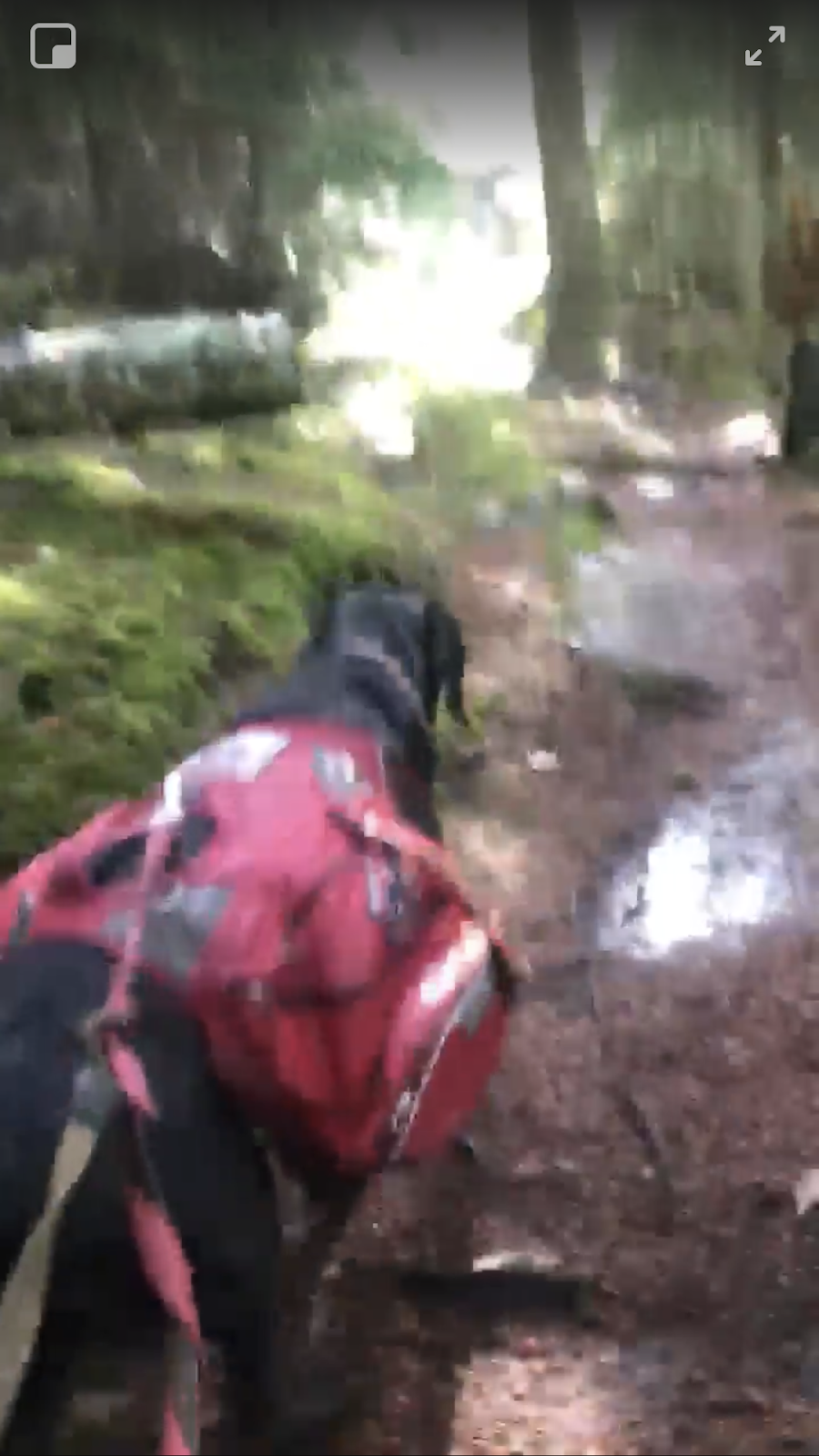
Forest has become unbelievably nimble and athletic, and he's always happy to be back on the Trail. He's gotten so brave and agile at fording streams and crossing over high, narrow foot bridges. For the next 200 miles, we're going to encounter a lot more rock climbing and maneuvering. For that reason I'm paying extra attention to his feet to be sure he doesn't injure himself. I don't like the boots they make for dogs; I've found that he needs the dexterity that comes with direct contact with the earth. I've actually seen him use one toe at a time to navigate tough spots, and the boots don't allow that. I'm still carrying boots and socks for him, but they will play more of a first aid role—if he has a foot that seems to get sore or a pad gets cut, I can put them on him to provide padding or give a worrisome spot a chance to heal.

Maine is absolutely beautiful and I love it, but there is one thing that I don't see as often as back in the South: cold, clear mountain springs that you can see bubbling up from the source. Where you do find a spring here, the water is warmer and colored like tea, probably from all of the tannins from the pine trees. There are a lot of birch trees, which are a pretty change, but I'm continually seeing places where bushcrafters are peeling the bark off. I'm not sure if they realize that in many cases it will eventually kill the tree.

Psychologically, I'm not hiking the whole Trail any more; I'm hiking to one town at a time. Being in town stresses me differently than the Trail does, and because of my PTSD I approach my tolerance limits quickly. I'm starting to miss home a lot, but I can't let that become overwhelming. I have to trust the voice of the guy that came up with this plan back in January, and not the voice of the guy who's missing home and bone tired.

We stopped a few times today to rest my ankle and grab food, so we made about 8 miles today. We stopped just past Spaulding Mountain Lean-to (about Mile Marker 202) and set up camp.

Sunday, July 29, 2018

Crocker Mountains

We got back to the trailhead in the early afternoon, where there was a map showing the northbound trail. I took advantage of it to shoot an instructional video explaining some of the terrain terminology I've used, which might be unusual to those of you who don't hike or live near mountains and can be hard to visualize on a two-dimensional, flat map. I used some primitive tools as an analogy: my hand and a Sharpie, and drew some lines to represent the contour lines on a map. πŸ˜† Flat, my hand isn't very helpful. However, if you look at my fist, you can imagine that the knuckles on my hand are mountain peaks. The depressions between the peaks are saddles, or what on the Trail I refer to as "gaps." Campsites or trailheads (parking lots or access to roadways) are often located in those gaps. The gaps are so deep and steep in this range that they call them "notches" here. I hope this is helpful in clarifying some of the geographical references I make in the blog from time to time. I wonder how long it will take for the Sharpie to wear off...


Stormy weather continued off and on all afternoon. We hiked about 5 miles up the Trail to the 4,000-foot Crocker Mountains, and decided to make camp in the gap between the North and South Peaks (the green summit symbols on the map below) at about 8:15 p.m. 


We got dinner and settled in the hammocks as quickly as possible, with lightning and thunder all around us. It's supposed to finally begin to clear in the morning. I'll be so glad to have better weather and actually be able to see farther than the peak we are standing on.

Saturday, July 28, 2018

Day 2, The Stratton Motel and Hostel

Since the weather report was just calling for more rain and wind Friday, I decided to stay put, get my gear organized, rest up and do some further planning for the coming mountains. I spent some time relaxing out back of the hostel, sitting under a tree and watching the river flow by. When I saw an otter and two loons, I went inside and got my phone from the charger, but by the time I got back outside, they were gone. Finally, I checked out Forest's paws to be sure they look healthy for the coming mountains. I've read that their paws get stronger, thicker and tougher the more they hike. Over 800 all-terrain miles on these paws, and they look great!


I'm also so happy to have my new shoes for this next stretch of trail. Thanks again, Thomas M. Anderson, Jr.! The last rock climb did the last pair in; less than 400 miles on those.


This morning (Saturday) we got a little bit of a late start. Trout has been so good to us that I wanted to wash our sheets to get Forest's hair off them for him. One less thing for him to do after we leave. We hit the trail a little before noon and headed south toward the mountains of western Maine. According to Maine Today Media, "This rugged 32-mile stretch is considered the most difficult section of the AT in Maine, with a daunting 10,000 feet of elevation gain over eight high peaks. Saddleback, The Horn, Spaulding, South Crocker and North Crocker all exceed 4,000 feet, and ambitious hikers can up the ante with side trips to Mount Abraham and Sugarloaf, two more 4,000-footers. Sections of exposed alpine terrain add to the challenge, but the reward is far reaching views that’ll knock your hiking socks off." We are supposed to have mostly sunny days Sunday through Tuesday, so I'm hoping to be able to enjoy those views fully.

Thursday, July 26, 2018

West Peak, Horns Pond Lean-to and Stratton, Maine

We got up early this morning to just more pouring rain, wind and thunderstorms. I had originally planned on picking up my resupply package in Stratton and moving straight on toward Sugarloaf and Saddleback Mountains, but the weather was just too miserable to keep going much further today. Instead, I decided to get a room for the night at the hostel where my package is waiting. We left Bigelow Col Campsite this morning at about 7:15 with about 8 miles to go to the trailhead.

Often, we're hiking through clouds at this elevation. Even when it's not really raining, we're being pelted with droplets in the cloud, almost like being sandblasted. Between my glasses being covered in moisture, and being knocked over by the wind, it's been a tough 2 days.


Soaked to the skin and beaten by the rain and wind, we arrived at the ME 27 trailhead (Mile Marker 188.2) a little after 3 pm. We were picked up by the shuttle shortly after that and taken to the Stratton Motel and Hostel, where we were met by the kindest and most accommodating host, "Trout." A fellow veteran, Trout was great to me, going above and beyond, a true brother. He made sure Forest and I were dry and comfortable as quickly as possible. If you're ever near Stratton, Maine, and need accommodations, I highly recommend:  The Stratton Hotel and Hostel

I picked up my resupply box (Yeah! New shoes!) and headed to the room to dry off and shower, before going out to find food. While I ordered a burger and a milkshake, Forest showed off a little in the restaurant by demonstrating how good he is at ignoring food dropped right in front of his nose. He was trained to ignore things on the floor, so he wouldn't endanger himself by picking up dropped medications or foods that are toxic to dogs. I can't promise that he is this disciplined around my 5-year-old, but when he's wearing his work gear (i.e., vest and head harness) he knows these things are off limits.


After dinner we headed back to the hostel and fell into bed. Forest and I are both beat from all of the up and down climbing and rock navigating over the past days.

Wednesday, July 25, 2018

The Bigelow Preserve, Avery Peak and Bigelow Col Campsite

I was up early this morning and had a little time to enjoy the view of the lake and explore a bit while Forest ate and digested his food. To the north it was partly sunny, but to the south—the direction I'm headed in—it looked mostly cloudy.


Lots of normal storm debris laid along the bank of the lake, but there was also a rock with one side covered in something unidentifiable. Perhaps some remnants from emerging hatchlings.


Today's hike took us past the Little Bigelow Lean-to and along the ridgeline of the Blue Mountains and the Bigelow range. The hike included 6 major peaks and some minor ones—lots of elevation changes. The upper elevations of the Bigelow Preserve lie within a state Ecological Reserve specifically set aside to protect and monitor natural ecosystems, which means that staying on the Trail is mandatory, and camping is not allowed above the treeline. It was a classic ridge walk on a mostly cloudy, breezy morning, but the weather deteriorated quickly as the day passed. Rain with 15-mph  winds and shoes worn smooth on the sole are not a very safe match for walking on granite. We decided to hike on over Avery Peak and set up camp at Bigelow Col Campsite for the night. Luckily, my new shoes are waiting for me at my next resupply point. I plan to arrive there Thursday afternoon.


Tuesday, July 24, 2018

Flagstaff Lake

Today's hike took us through relatively easy terrain. We crossed Sandy Stream and Middle Road shortly after leaving. Then, we skirted the southern end of West Carry Pond, where we passed West Carry Pond Lean-to. From there, we crossed Pond Stream and wound around Roundtop Mountain. Just after crossing Jerome Brook, we passed the trailhead at Long Falls Dam Road and hiked to the southeast edge of Flagstaff Lake, where I decided we would stop for the night and set up camp a little before 8 p.m. (around Mile Marker 170).


It's very windy by the lake tonight, which is making waves on the water. The trees are swaying, which is moving us around. Usually I like the sway of the hammock and sound of the wind, but tonight it worries me that branches could fall on us. My cell signal is weak, but I was able to text with my wife for a bit.

It's not crowded on the Trail right now. We pass a few NOBOs a day. Most of the SOBOs who started at the same time as us have either passed us or fallen behind or quit.

I realized today that I left everyone hanging yesterday about the ferry. Forest did great in the canoe; he seemed to actually like riding in it and wasn't in the least bit nervous or afraid. I truly think this dog was a thru-hiker in a previous life! 🐢🐾⛺🚢

Monday, July 23, 2018

East Carry Pond

I decided to stay at The Caratunk House last night. It had poured all afternoon and was still raining when we arrived, so it was best to get dry inside instead of trying to set up camp. It also gave me a chance to sort through my resupply boxes and repack. My wife is so thoughtful; she always tries to include a little surprise in with the necessities. Today, it was an apple crumb pastry. I also got my sleeping bag and quilts, as we expect colder temperatures in the White Mountains of New Hampshire.  It's only a 3-day walk to my next resupply. After that, we have a tough 200 miles. First, we will come to the Bigelows, Sugarloaf Mountain, and Saddleback Mountain in Western Maine.


Next, will be the Presidential Range of the White Mountains, which are reportedly the most difficult part of the entire Trail. A lot of ridge walking on solid granite. Luckily, I'll have my new shoes by then. I'll be watching Forest's paws carefully, too. It's supposed to rain a lot in the coming week. I'm hoping it clears before we get to the Whites; hiking on wet rock can be dangerous.


It was a little hard for me to get going this morning. My back was hurting a lot from all of the rock climbing and the stream crossings. After I had a wonderful breakfast at the hostel, Forest and I headed back to the Trailhead at about 11 a.m. and hiked south to the Kennebec River Ferry. "Ferry" is a word that is used lightly; it's actually a man who takes both northbound and southbound hikers across the river by canoe. He is used to ferrying hikers with dogs, but it was a new experience for Forest. I was excited to see how he'd do. (More to follow when I have cell service again.)

Photo Credit: DownEast, The Magazine of Maine,
"Keepers of the Trail", Michael D. Wilson


After the ferry, we had an uneventful 10-mile walk past Pierce Pond Lean-to. We stopped for the night between the Trail and the northwest shore of East Carry Pond at about 8:15 p.m.


Here are a couple of additional views from yesterday's hike to Caratunk.


Sunday, July 22, 2018

Moxie Pond Rd to Caratunk

After we broke camp this morning, we set out on our 10-mile hike to Caratunk, where my resupply package was waiting. We hiked out through a low, swampy and buggy area and crossed a brook. After that, the trail began to climb to the top of Middle Mountain. At this point we took a break, and I finally found some ripe blueberries for lunch. (While at the Lakeshore Lodge, I was able to delete some photos that were duplicates or fuzzy, so I was able to take a few new ones today.)


After our break, we hiked on past Pleasant Pond Lean-to, at the northernmost edge of Pleasant Pond, and continued along the mountain ridge to the top of Pleasant Pond Mountain. I've heard that you can see Mt. Katahdin from there on a sunny day, but it was cloudy and rainy today. A steep 2,200-foot descent led us down to the US 201 Trailhead (Mile Marker 151.2), and from there it was just a short walk to The Caratunk House to pick up my package.

How It All Began

In August 2017 Canines for Service Inc. in Wilmington, NC, provided Service Dog Forest to me (U.S. Army Veteran "Fisher"). It was ...